The design guidelines are presented here by the owner, the Boston Housing Authority (BHA), to prospective developers. Although they are for a specific housing project, they reflect the current thinking in how to make public housing work. Major design issues center around supporting mixed incomes, making appearance similar to private housing, and encouraging safety through design (this concept has been put forth by Jane Jacobs as "eyes on the street"[21]).
Ideally, the urban design GIS could offer the planner insight into creating mixed communities with the pattern finding application if unit by unit income data were available. One procedure would be to find neighborhoods in which the desired range of incomes were present. The planner could also specify what percentage of the community should fall within certain income sub-ranges. After places that met the criteria were identified, other household characteristics could be studied such as rent, education, place of birth, length of occupancy, building age, parking, distance from public transportation, etc. to further develop an understanding of the composition of a viable mixed income community. As mentioned, this analysis can not be performed well given the current level of detail in census data, but it may be redundant anyway, as the fulfillment of objective two may be the catalyst for the fulfillment of objective one.
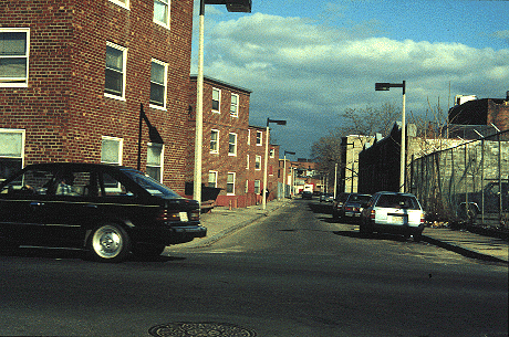
Understanding the difference in urban form is straightforward. Simple visual observation shows a marked difference in building form in plan (Figure 25) and in perspective (Figure 26) between public housing developments and neighborhoods that have formed organically. The planned developments are the antithesis of the organic ones. Residences rarely face the street and public areas relate to the entire development instead of to any one residence. There are few streets in the developments (Figure 27), so no one passes through except people connected to them. South of Mission Main, organic development takes a less dense form as we move away from the city center. There are many neighborhoods of single family homes of one and two stories along with triple-deckers.
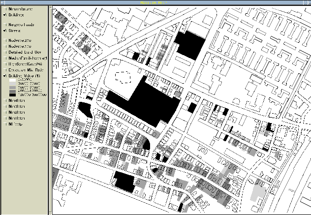
Although visual analysis works well here to identify the difference in urban form, an urban design GIS should be able to quantify and operationalize this difference so that the designer gains a another understanding of the difference and so that their methods can be applied over larger areas. The difference in building form might be quantified using an area to perimeter ratio (area / perimeter). The mean of this ratio is twenty-eight for the group of institutional buildings to the northwest of Mission Main, nine for the residential area to the southwest of the development and twelve for the development itself. At first glance, this seems to suggest that a lower building to area ratio would better match the neighborhood, but once again, scale, resolution and the richness of the data set are important because a townhouse can have the same general shape as a public housing tenement, with the major differences being in the architectural detail, building quality, upkeep, number of units and location.
Contrasting the relationship of streets is more straightforward. The public housing developments rarely have streets in them, and when they do, these streets often dead end in the development. Organic neighborhoods contain more streets and they usually culminate in intersections instead of dead ends.
Small nodes seem to be another characteristic of organic neighborhoods, like the BCA node in the South End, but they are absent from the immediate Mission Main area. Two minor nodes can be found south and west of the development, but these are associated with other neighborhoods (Figure 27). If the "home zone" of Mission Main residents could be expanded to include this area, this might not be a concern, but as it is, residents only seem to consider the development as familiar territory.[22]
So three conditions have been identified whose spatial characteristics differ markedly in planned neighborhoods versus organic ones, building form, streets and nodes. Many others probably exist and each designer should be able to use the GIS to develop and quantify their own individual ideas.
A designer might begin to look at solving this "wicked" design problem[23] with the tools and methodology developed earlier. Nodes address the problem of the edge between residential and more public areas well, so here is one way in which the edge condition might be addressed. For argument's sake, we begin with the assumption that the designer feels that it is important to create a node in the Mission Main neighborhood. There are presently no nodes in the area because land uses are largely limited to institutional buildings, their associated parking lots and public housing. The designer might explore the possibility of creating a node by inserting commercial, recreational and mixed uses in certain areas of the neighborhood, most likely addressing the edge condition by placing these uses on the northern and western edges of Mission Main (commercial establishments could attract the business of workers in the institutional areas).
By doing this in the GIS and running the node algorithm, a relatively objective judgment regarding the likely success of the design intervention can be generated. With these new land uses in place, the planner can say that given the development of certain areas in the manner described, a certain size node will be created. Other nodes of this size look like place X, place Y and place Z. There are a lot of assumptions in this scenario. Most significantly, the node finding algorithm must be accurate and nodes of certain sizes must be comparable, but at least a design methodology has been created which can be challenged, debated and refined, instead of a design proposal which seems to coalesce in the mind of the designer.
The benefits of using GIS to address this objective are numerous. Everyone in each agency would have immediate access to everyone else's latest updates to the database, the need for time and effort-consuming face-to-face meetings would be reduced, and all the information would be accessible on any desktop with a computer and a network connection. In addition to these efficiency issues, sharing information in this way allows the designer to integrate everyone's information into analyses of the kinds described above. Using this system, more information is likely to be considered as part of the project, and the actions of agencies is more likely to coordinated.
It will be difficult to integrate the development into the larger community because the site is largely isolated from other residential neighborhoods. Any efforts in this area should focus on connecting Mission Main to areas south of the development, the only direction which offers an opportunity for connection to a larger neighborhood. As the non-residential areas surrounding the development consist of major institutions (hospitals and colleges), there is little that can be done towards addressing edge conditions by changing the physical form of these places. It would make more sense to emphasize that edge and focus energy on connecting the development to southern and western neighborhood areas.
Figure 24: Identifying "Mixed" Communities
Figure 25: Urban Form in Plan View
Free Market vs. Public Housing
(arrows point to public housing)
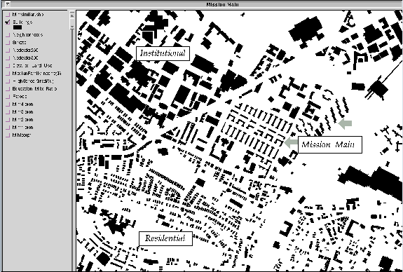
Figure 26: Urban Form In Perspective View
Free Market vs. Public
Housing
(a) 1960s/1970s-era public housing (Orchard Park)
(b) A highly desirable pre-World War II-era high density free market
neighborhood (South End)
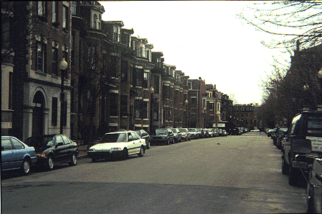
Figure 27: Nodes around Mission Main
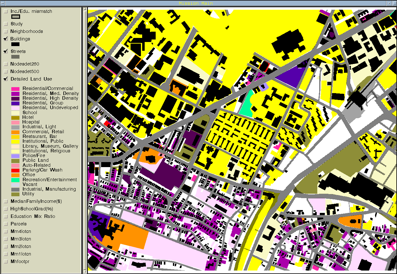
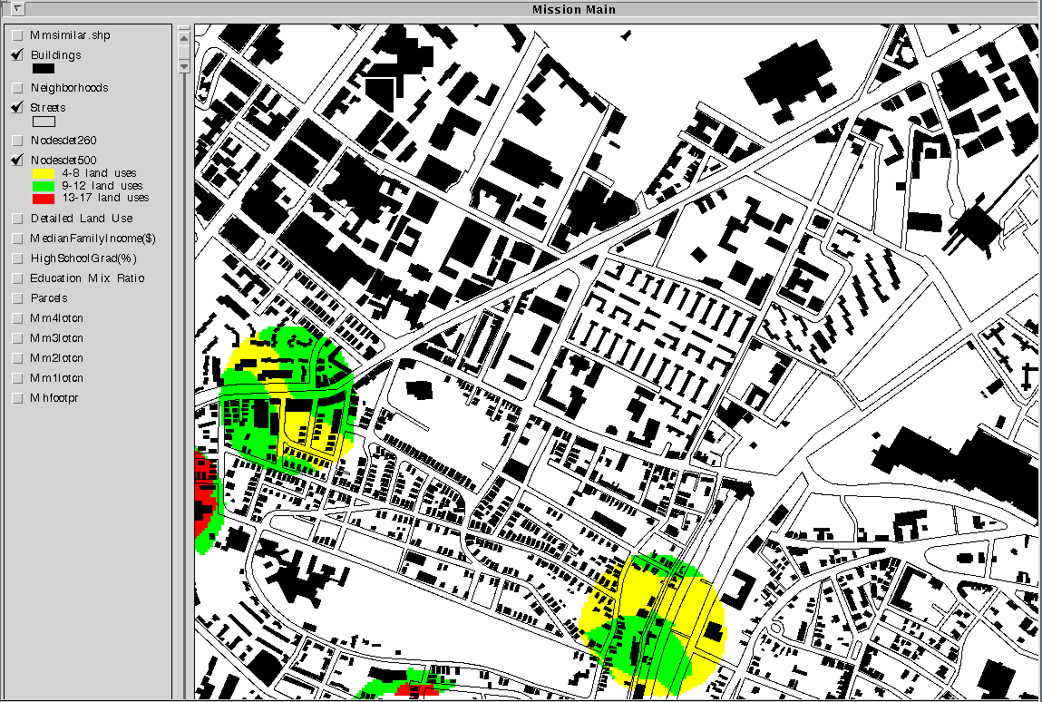 Figure 28: Land Use around Mission Main